----------------------------------
Terrain Modeling & Cut/Fill Volumes: A Comprehensive Overview of the Process
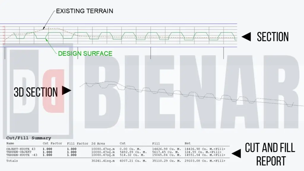
In this project, we’ve utilized Civil 3D to model both the existing terrain and the proposed design surface. This process has allowed us to calculate the cut and fill volumes, which are essential for guiding the earthworks phase and ensuring the efficient management of materials during construction.
What is Terrain Modeling?
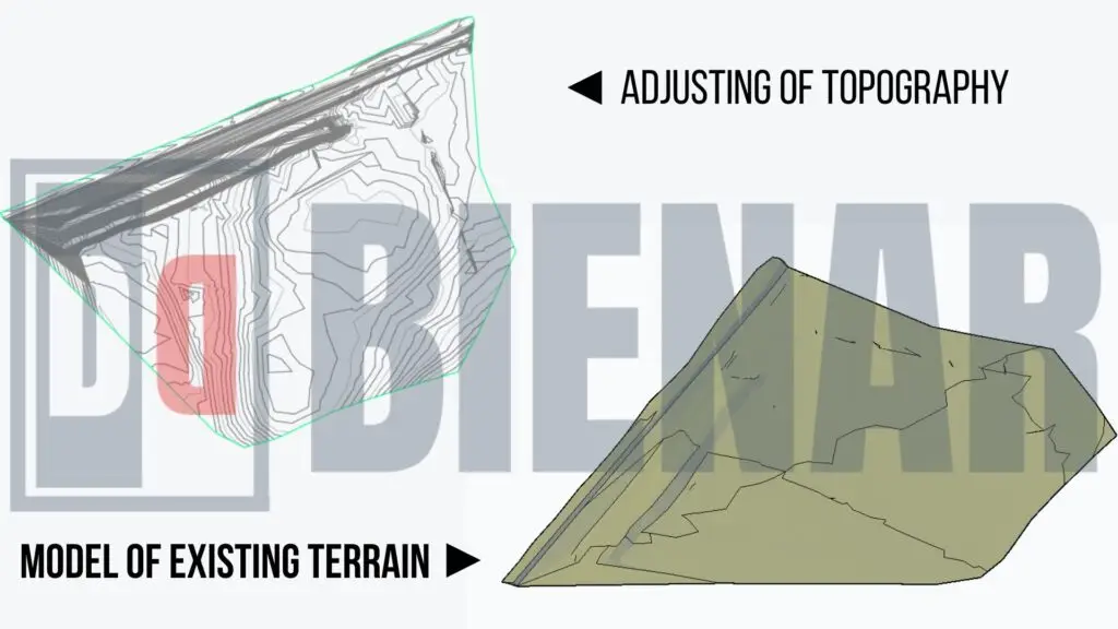
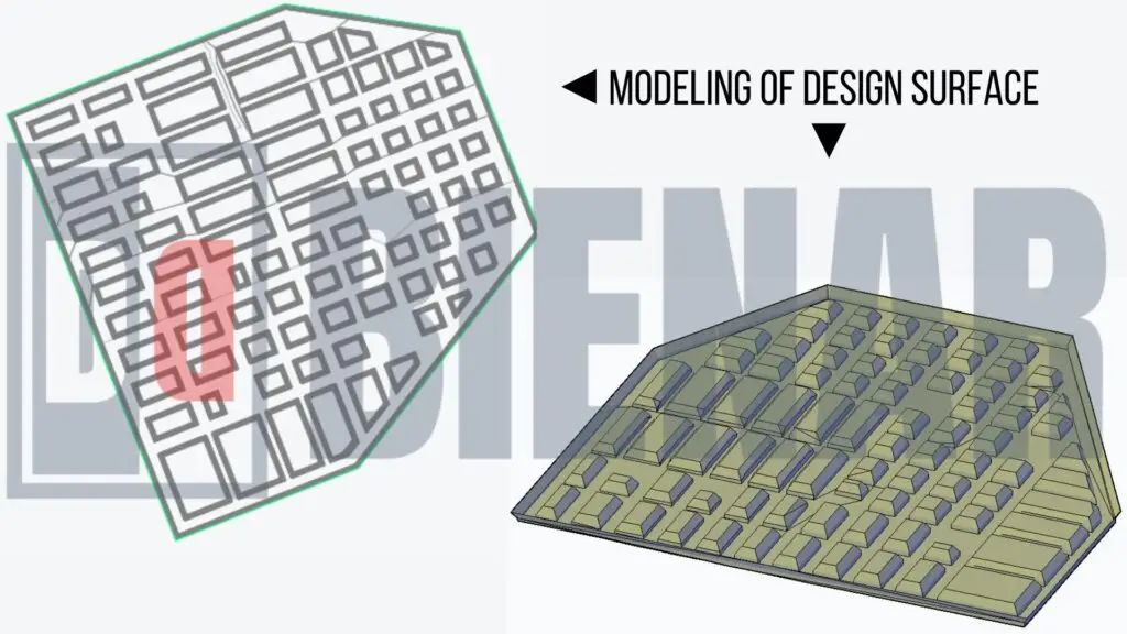
Terrain modeling involves creating a detailed digital representation of the natural landscape, capturing features like elevation, slopes, and contours. Using Civil 3D, we imported topographical data from surveys and generated an accurate model of the existing terrain. From this, we created a design surface that represents the planned changes to the landscape, such as grading and excavations for roads, buildings, or other infrastructure.
Cut and Fill Volumes: Why They Matter
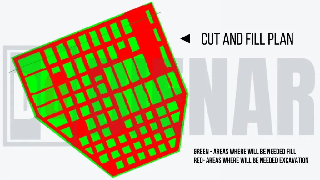
Calculating the cut and fill volumes is crucial for any earthworks project. These calculations identify the amount of material that needs to be removed (cut) and the amount that needs to be added (fill) to achieve the desired design surface. By calculating these volumes, we ensure that the project stays within budget by providing accurate material quantities, preventing excess material from being moved unnecessarily, and ultimately optimizing the construction process.
The cut and fill volumes are calculated by comparing the existing terrain surface to the design surface, and the results are presented in a clear and detailed report. This report not only outlines the total volumes but also helps with construction sequencing, material transportation planning, and cost estimations.
Visualizing the Final Works
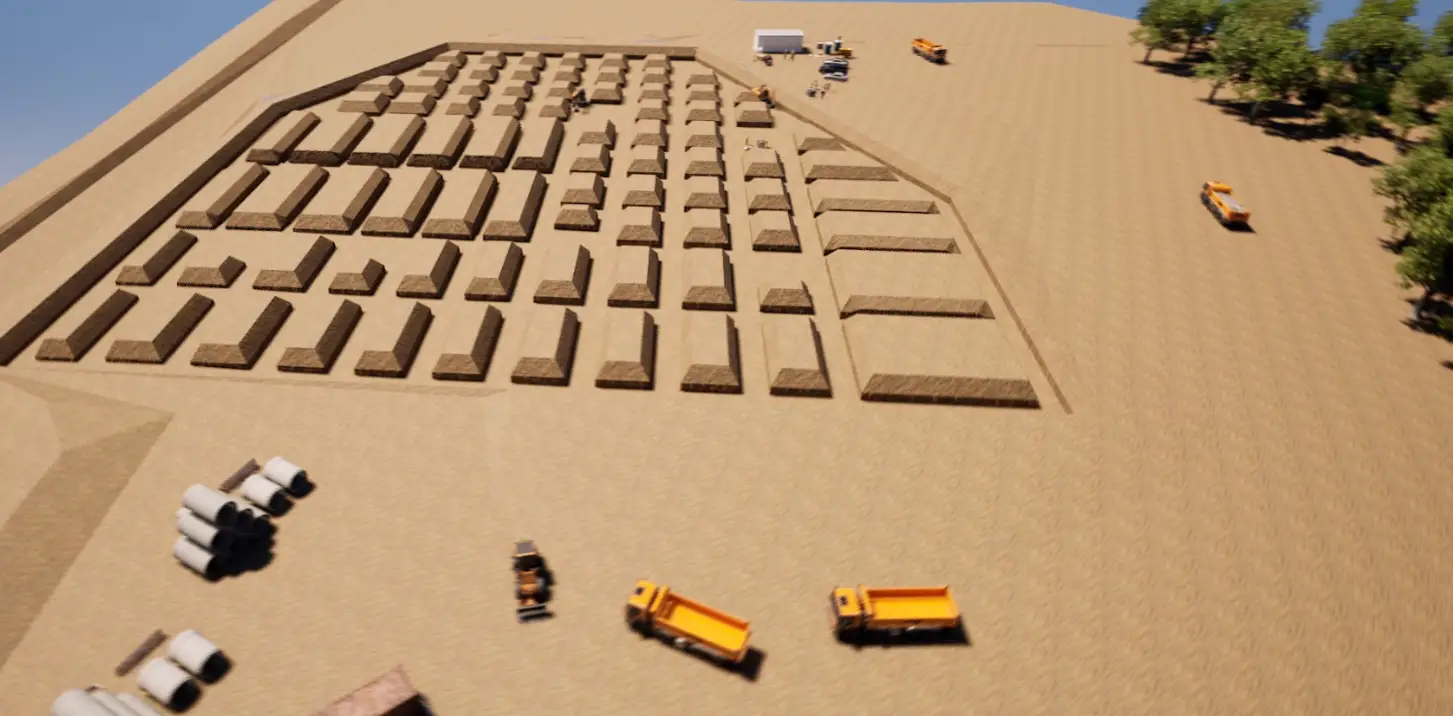
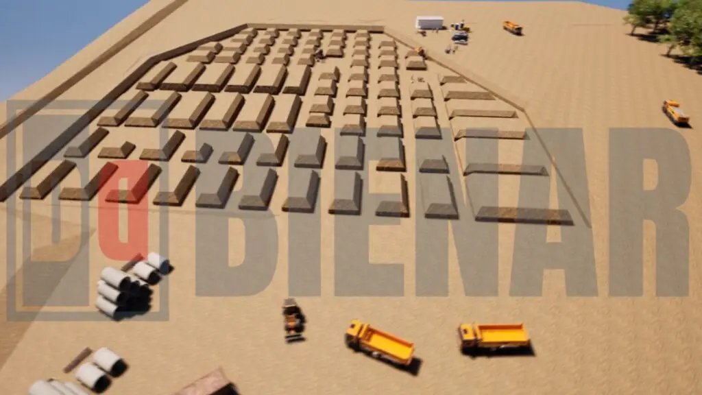
To bring the entire process to life and provide a better understanding of how the terrain and design surfaces will evolve throughout construction, we’ve also created a 3D animation showcasing the final design and the earthworks process. This dynamic animation visualizes the entire transformation of the terrain, showing how the project progresses from the existing conditions to the completed design. It’s a valuable tool for presenting the project to stakeholders, ensuring alignment with the design vision, and facilitating discussions on the earthworks logistics.
Key Project Highlights:
-
Detailed Terrain Modeling: Using Civil 3D, we accurately modeled the existing terrain and the design surface, allowing for a comprehensive view of the project site.
-
Cut and Fill Calculations: The precise calculation of cut and fill volumes provides the project team with the information needed to manage earthworks effectively and ensure that material quantities are optimized.
-
Comprehensive Reporting: A detailed report was generated, summarizing the cut and fill volumes, material requirements, and other key data to support construction planning and cost management.
-
3D Animation: The final design and earthworks process were visualized through an animated sequence, offering a dynamic representation of the project’s progress and helping stakeholders better understand the scope and impact of the proposed changes.