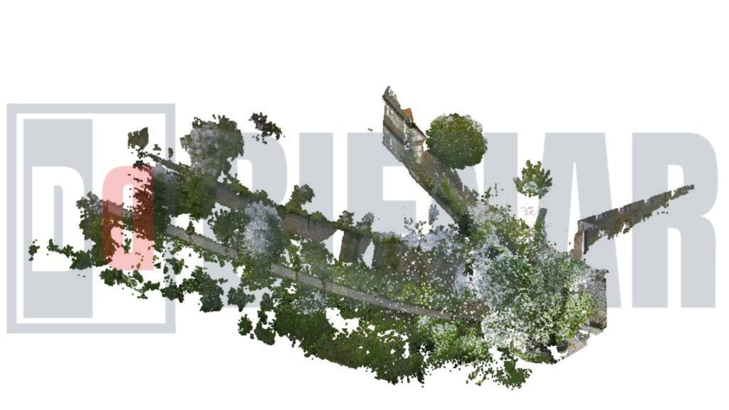
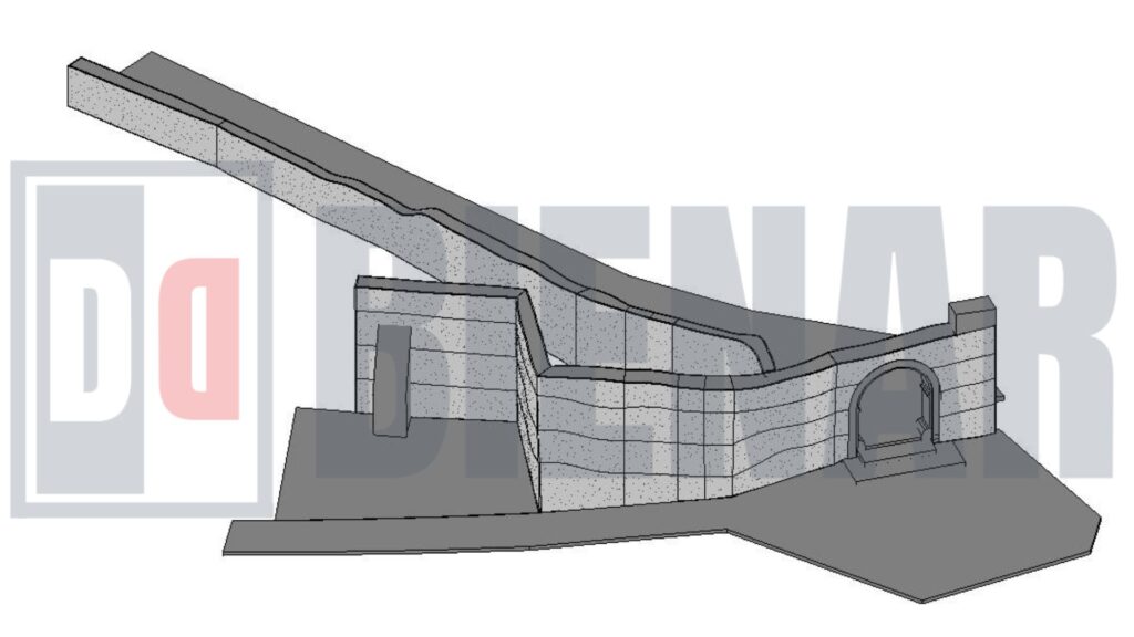
This project involved capturing the existing conditions of Blomberg’s historic city wall using advanced 3D scanning technology. A high-resolution point cloud of the entire wall was created, precisely documenting in detail its current state. This data-rich point cloud was then imported into Revit, where a detailed BIM model was developed to replicate the wall’s unique features and characteristics.
Every aspect of the wall’s architecture was carefully recreated in Revit based on the point cloud data. The process demanded meticulous attention to ensure that each section and feature matched the real-world conditions captured by the scan. The BIM model now serves as a digital twin of Blomberg’s city wall, offering a reliable resource for future preservation, maintenance, and planning efforts.
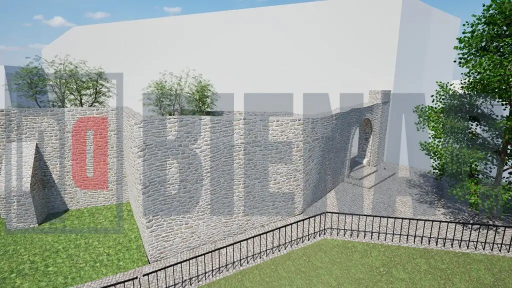
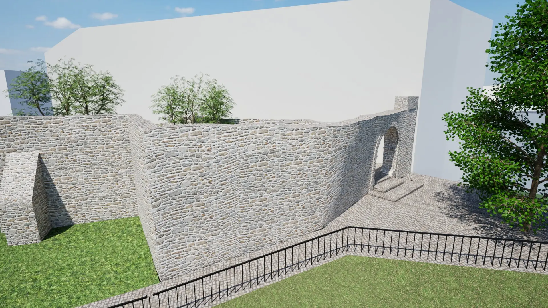
To illustrate this modeling process, an animation was created, guiding viewers through the model and highlighting significant historical and architectural features. This animation provides an immersive experience, allowing the community and stakeholders to visualize the wall’s structure and heritage from multiple perspectives. It offers a comprehensive walkthrough of the model, demonstrating the precision and depth achieved in capturing the wall’s actual conditions and transforming them into a functional, data-rich BIM environment.